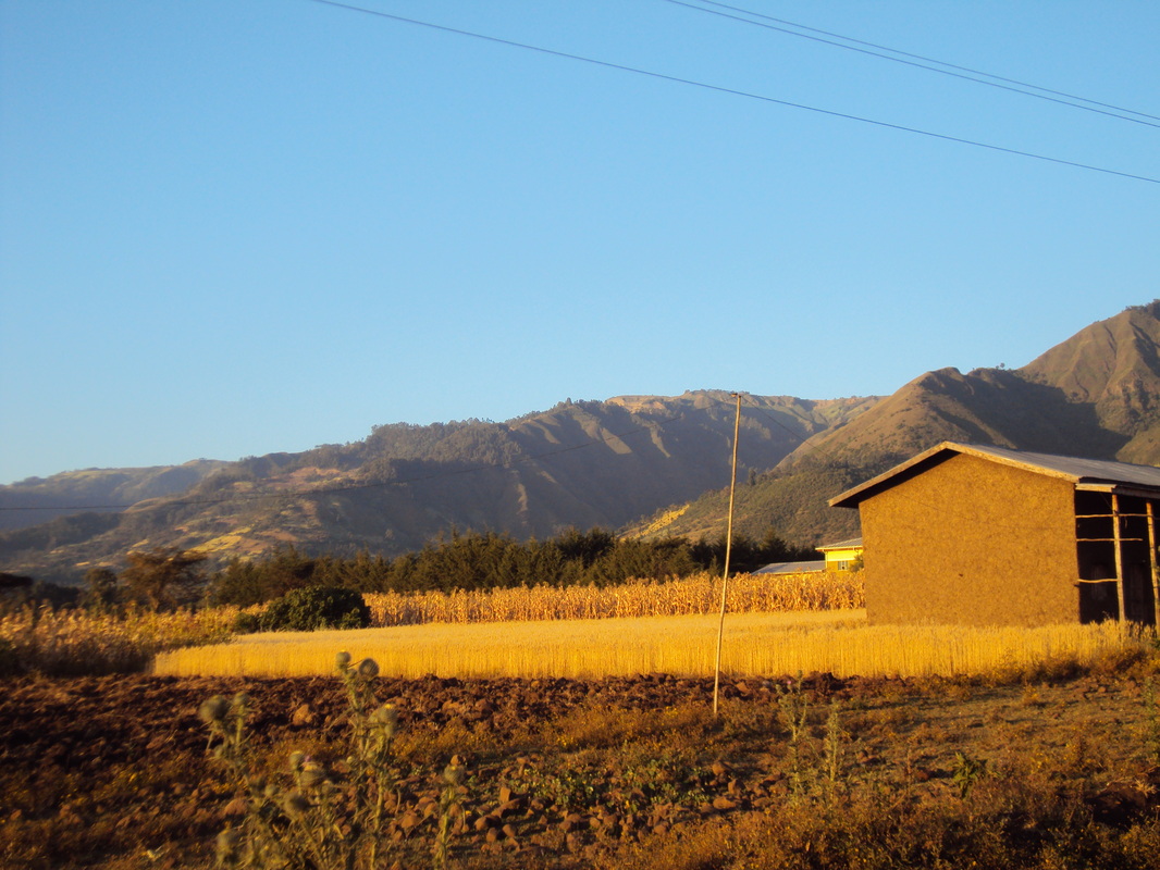
The edge of Mt. Gurage fades into the distance above a tef field illuminated by the morning sun during harvest season (November).
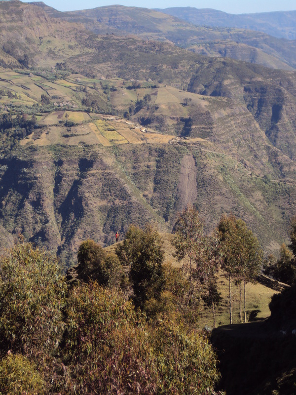 Looking across the "Fanna" canyon to the North, near the top of Mt. Gurage
 Starting from the Project Mercy Hospital, the hike up Mt. Gurage is an unforgettable ascent up 5,000 ft. of rugged and beautiful terrain, passing villages, forests, canyons, and waterfalls. At the top, you truly feel like you have reached the roof of Africa as you gaze across the Great Rift Valley to another mountain range only visible up here above the haze line. The mountain is a giant plateau at around 12,000 ft. above sea level, and the climate and distinct culture here combine to make you feel like you have entered another world - a world still isolated from the steady march of modernization and globalization, where people often ride to the market on horseback through verdant meadows reminiscent of the Scottish highlands, where traditional houses and traditions themselves prevail, and where the ways of life seem as old as the wind that rushes across these cold plains.
Starting from Project Mercy Hospital in Yetebon (accessible by a 10birr/kilometer bajaj ride from Butajira), the trail heads directly west, off the main road, past the primary local store, and through a field littered with trash as it approaches the mountain. To the south/left side, there is a deep, forested ravine, which is a favorite spot of the monkeys in the area. If you are patient and observant enough, you are almost guaranteed to see them here. As you apprach the base of the mountain, there are various footpaths diverging in all directions, but the best bet is to keep the ravine directly to your left in order to find the most principal path, which follows a zig-zag path up the first and steepest section of the climb. At the top of the first "knoll," you will see incredible views of a river and its canyon to the north, where "Fanna" is located. Continuing past this area, follow the main trail as it winds up and to the southwest through a forested area, past some houses, through a boulder field and finally alongside another deep gorge on the south side. The trail passes under some old-growth forest and comes out for another view atop the second "knoll" before continuing upwards and widening out significantly, with some stretches of paved stones. It passes several houses before coming to a T-intersection - the easiest and fastest route to the Wuhjebar market/town is left. The extremely astute listener may notice a different language being spoken here, "Siltenya" as you have passed into the land of the Silt'e people, though you are still in the Gurage Zone. As the trail continues to curve back to the West, you will begin to pass through some beautiful fields and level off with expansive views opening up behind. In this area, the third and final "knoll" will be visible to the South. There is a mosque at the top with a friendly guard who will be especially friendly and let you look around the grounds if you are accompanied by a local.
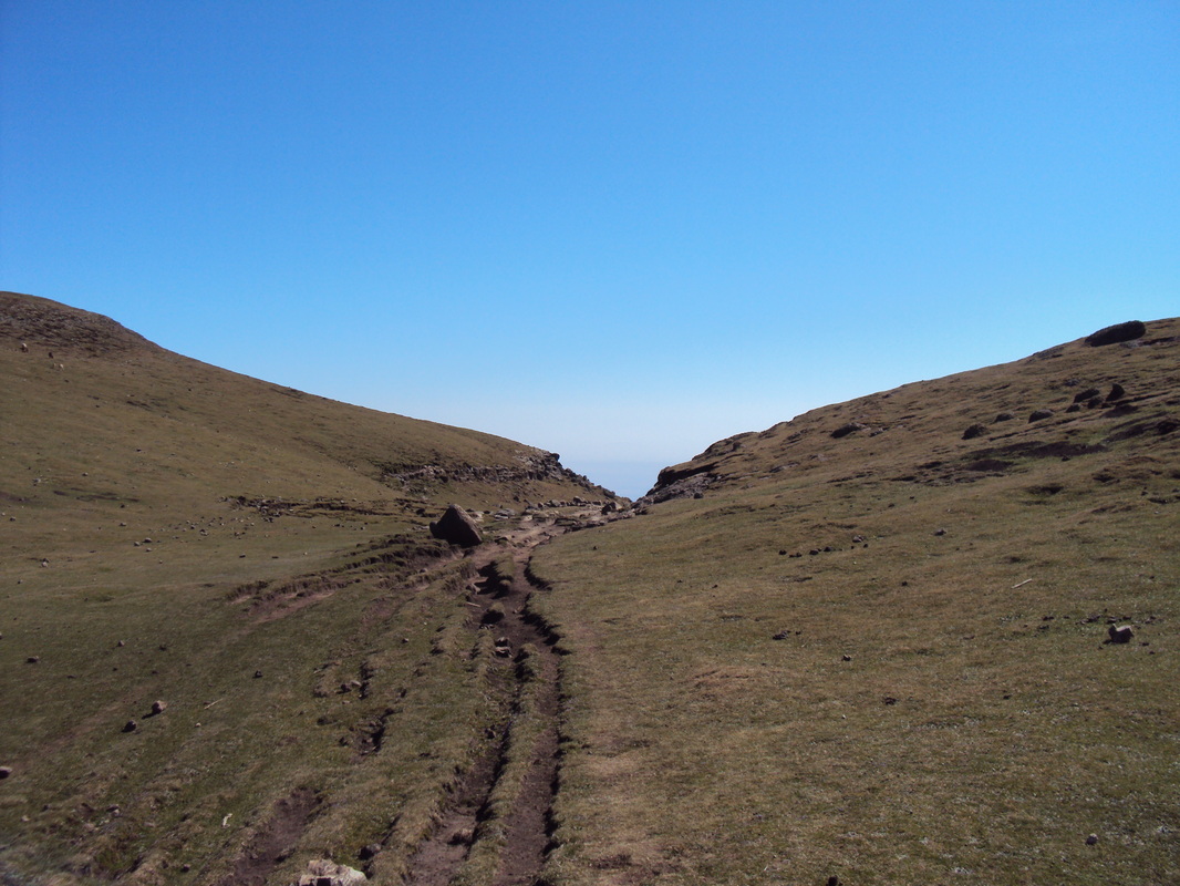
The trail continues as a gentle stroll along the mountain (you will notice that the temperature has dropped quite a bit), past houses with rows of trees and bamboo on either side. One of the houses that lies very close and within sight of the trail is home to a friendly man who has in the past welcomed visitors to his home, where you can observe the impressive architecture of this surprisingly large traditional house. Otherwise, the trail continues along the fence rows until coming out into a gorgeous open field area at the very edge of the mountaintop. Passing this edge, you will begin to feel as if you have truly passed into another world. Moss and lichen-covered boulders are strewn across the lush, rolling plains of this public grazing area that looks almost as if it was maintained by a professional lawn-care company. Follow the small valley that starts to form ahead alongside a small stream, past some peat fences, and along a straight stretch. Eventually the main path diverts to the left, crosses the stream on bedrock and continues through the rolling hills. Eventually you will come to a gravel road. Turn left/south to arrive to the town of Wuhjebar. On market days, there will be a steady stream of foot traffic and most notably, riders on horseback going up and down the road, showing off their horses for the livestock market.
The following information applies to market days, which are Wednesdays and Sundays in Wuhjebar. From Wuhjebar, you can catch a minibus West over the mountain to Welkite (1+ hours), North to another market town (5-10 birr, 10 minutes), or East back to Butajira down the incredible new multi-million dollar winding mountain road completed June 2014 which unites the principal cities of Butajira and Welkite (recommended) (50 birr, 30 minutes). On the Southwest side of the town, a path leads out of the town and to two lakes (second is more scenic), separated by a grassy hill. The Kokeb Hotel (Muslim business) is a good place to get some tibs or use the pit toilet, but probably not the best place to stay unless you find yourself out of luck.
Starting from Project Mercy Hospital in Yetebon (accessible by a 10birr/kilometer bajaj ride from Butajira), the trail heads directly west, off the main road, past the primary local store, and through a field littered with trash as it approaches the mountain. To the south/left side, there is a deep, forested ravine, which is a favorite spot of the monkeys in the area. If you are patient and observant enough, you are almost guaranteed to see them here. As you apprach the base of the mountain, there are various footpaths diverging in all directions, but the best bet is to keep the ravine directly to your left in order to find the most principal path, which follows a zig-zag path up the first and steepest section of the climb. At the top of the first "knoll," you will see incredible views of a river and its canyon to the north, where "Fanna" is located. Continuing past this area, follow the main trail as it winds up and to the southwest through a forested area, past some houses, through a boulder field and finally alongside another deep gorge on the south side. The trail passes under some old-growth forest and comes out for another view atop the second "knoll" before continuing upwards and widening out significantly, with some stretches of paved stones. It passes several houses before coming to a T-intersection - the easiest and fastest route to the Wuhjebar market/town is left. The extremely astute listener may notice a different language being spoken here, "Siltenya" as you have passed into the land of the Silt'e people, though you are still in the Gurage Zone. As the trail continues to curve back to the West, you will begin to pass through some beautiful fields and level off with expansive views opening up behind. In this area, the third and final "knoll" will be visible to the South. There is a mosque at the top with a friendly guard who will be especially friendly and let you look around the grounds if you are accompanied by a local.
The trail continues as a gentle stroll along the mountain (you will notice that the temperature has dropped quite a bit), past houses with rows of trees and bamboo on either side. One of the houses that lies very close and within sight of the trail is home to a friendly man who has in the past welcomed visitors to his home, where you can observe the impressive architecture of this surprisingly large traditional house. Otherwise, the trail continues along the fence rows until coming out into a gorgeous open field area at the very edge of the mountaintop. Passing this edge, you will begin to feel as if you have truly passed into another world. Moss and lichen-covered boulders are strewn across the lush, rolling plains of this public grazing area that looks almost as if it was maintained by a professional lawn-care company. Follow the small valley that starts to form ahead alongside a small stream, past some peat fences, and along a straight stretch. Eventually the main path diverts to the left, crosses the stream on bedrock and continues through the rolling hills. Eventually you will come to a gravel road. Turn left/south to arrive to the town of Wuhjebar. On market days, there will be a steady stream of foot traffic and most notably, riders on horseback going up and down the road, showing off their horses for the livestock market.
The following information applies to market days, which are Wednesdays and Sundays in Wuhjebar. From Wuhjebar, you can catch a minibus West over the mountain to Welkite (1+ hours), North to another market town (5-10 birr, 10 minutes), or East back to Butajira down the incredible new multi-million dollar winding mountain road completed June 2014 which unites the principal cities of Butajira and Welkite (recommended) (50 birr, 30 minutes). On the Southwest side of the town, a path leads out of the town and to two lakes (second is more scenic), separated by a grassy hill. The Kokeb Hotel (Muslim business) is a good place to get some tibs or use the pit toilet, but probably not the best place to stay unless you find yourself out of luck.
View to the East through wheat fields on the third knoll of Mt. Gurage as described below.
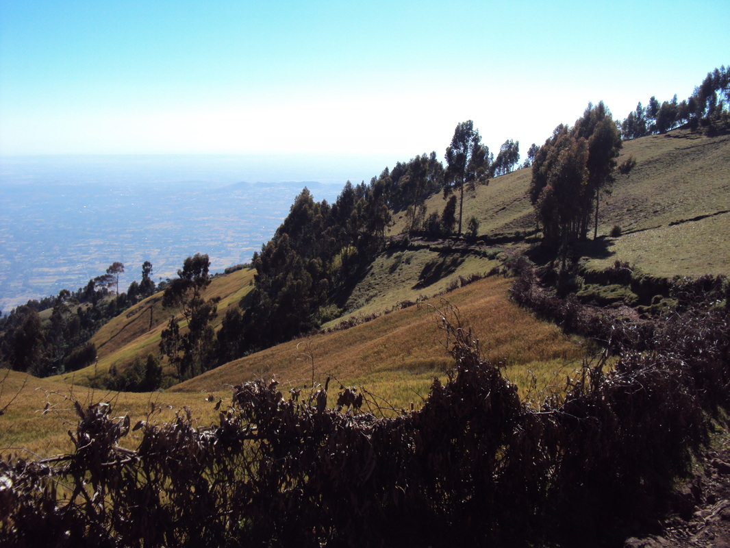
Looking to the West from the public grazing meadows on top of the mountain
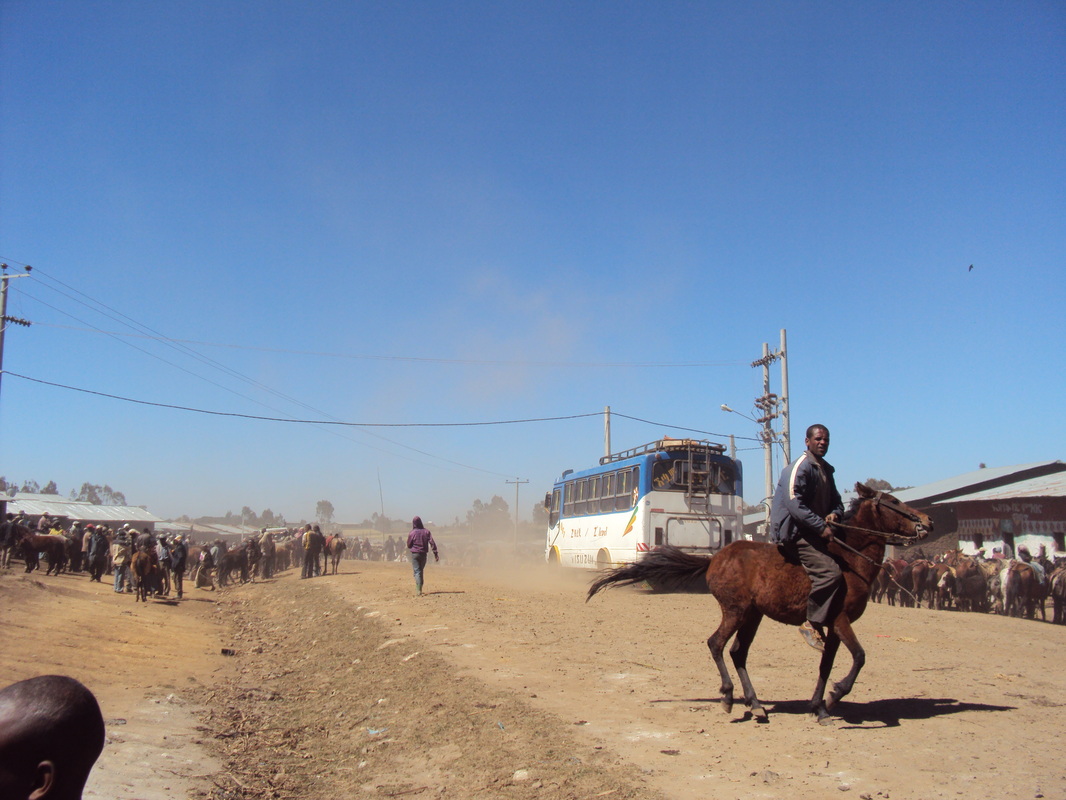
The dusty town of Wuhjebar is at its best on market days.
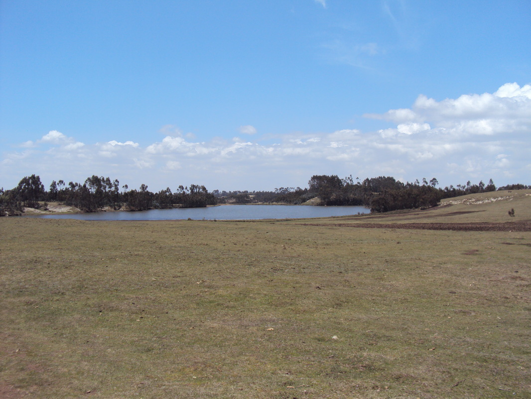
One of the lakes near Wuhjebar is visible in the distance.
 RSS Feed